


Voting District 130004, Oneida County, New York
About
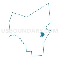
Outline

Summary
| Unique Area Identifier | 633056 |
| Name | Voting District 130004 |
| County | Oneida County |
| State | New York |
| Area (square miles) | 10.92 |
| Land Area (square miles) | 10.92 |
| Water Area (square miles) | 0.00 |
| % of Land Area | 100.00 |
| % of Water Area | 0.00 |
| Latitude of the Internal Point | 43.17442570 |
| Longtitude of the Internal Point | -75.23325120 |
Maps


Graphs
Select a template below for downloading or customizing gragh for Voting District 130004, Oneida County, New York


Neighbors
Neighoring Voting District (by Name) Neighboring Voting District on the Map
- Voting District 070001, Oneida County, NY
- Voting District 070002, Oneida County, NY
- Voting District 070003, Oneida County, NY
- Voting District 130001, Oneida County, NY
- Voting District 130002, Oneida County, NY
- Voting District 130003, Oneida County, NY
- Voting District 210001, Oneida County, NY
- Voting District 210002, Oneida County, NY
Top 10 Neighboring County Subdivision (by Population) Neighboring County Subdivision on the Map
- Marcy town, Oneida County, NY (8,982)
- Trenton town, Oneida County, NY (4,498)
- Deerfield town, Oneida County, NY (4,273)
Top 10 Neighboring Unified School District (by Population) Neighboring Unified School District on the Map
Top 10 Neighboring State Legislative District Lower Chamber (by Population) Neighboring State Legislative District Lower Chamber on the Map
Top 10 Neighboring State Legislative District Upper Chamber (by Population) Neighboring State Legislative District Upper Chamber on the Map
Top 10 Neighboring 111th Congressional District (by Population) Neighboring 111th Congressional District on the Map
Top 10 Neighboring Census Tract (by Population) Neighboring Census Tract on the Map
- Census Tract 262, Oneida County, NY (6,069)
- Census Tract 240, Oneida County, NY (4,498)
- Census Tract 239.01, Oneida County, NY (2,302)
- Census Tract 239.02, Oneida County, NY (1,971)